
Brooklyn · Neighborhood guide
Boerum Hill
Boerum Hill’s residential blocks bring rows of nineteenth-century houses together with the storefronts of Atlantic Avenue. Dean, Bergen, Pacific and Wyckoff streets offer several ways to look at the neighborhood’s architecture and its connection to Brooklyn’s waterfront and commercial growth.

Ritchiee212121 · CC BY 4.0 · Resized.

About Boerum Hill
The blocks developed for a mix of waterfront workers, merchants and commuters. Growth in the 1840s and 1850s followed industrial expansion and new transportation; development continued farther east after the Civil War, as the Gowanus Canal and nearby industry grew. Atlantic Avenue became a commercial corridor.
Many houses and small buildings with storefronts from the 1850s–70s use Greek Revival or Italianate designs. Later construction added other styles. The 2018 extension to the 1973 historic district covers three separate areas; neither designation defines the whole neighborhood.
Places to explore
Dean and Bergen streets
Between Smith and Hoyt streetsThe western section of the historic district extension includes these residential blocks. Compare the row houses and their stoops from the sidewalk; the buildings are homes, not public interiors.
Bergen Street row houses
103–109A Bergen StreetThis group of six houses was built in 1885 to designs by Amzi Hill. Their Second Empire and neo-Grec details include mansard roofs and geometric ornament. Look from the street and leave the entrances clear.
Atlantic Avenue and Pacific Street
Atlantic Avenue between Hoyt and Nevins; Pacific Street between Hoyt and BondThe northern section of the extension includes a commercial stretch and a nearby residential street. Look at the different ways row-house-scale buildings accommodate storefronts and homes.
Wyckoff and Bergen streets
Between Bond and Nevins streetsThe eastern section of the extension records a later phase of residential development near the canal. Compare the house fronts here with the older western blocks, keeping to public sidewalks.
Planning a visit
Bergen St on the F and G is an arrival point near the western blocks. MTA line maps describe usual weekday service; check current service changes before traveling.
Choose a few blocks rather than treating the district as a museum. Homes, stoops and entrances are private, and individual shops set their own hours.
Photos
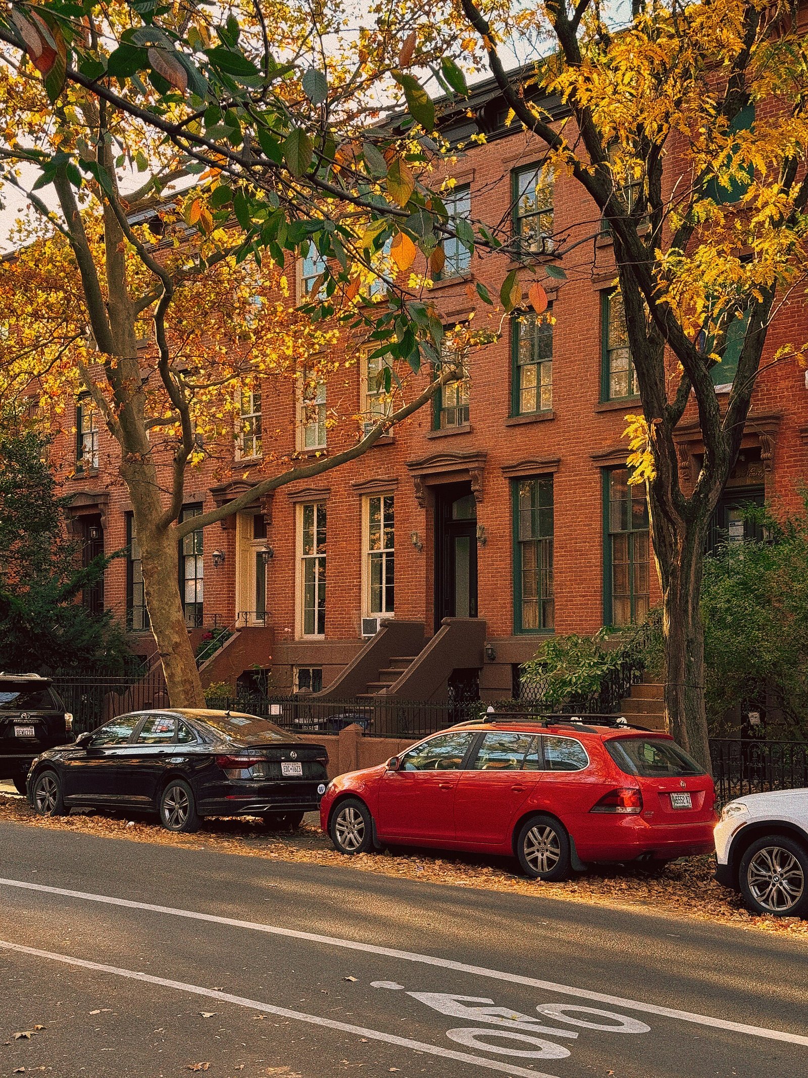
Ritchiee212121 · CC BY 4.0 · Resized.

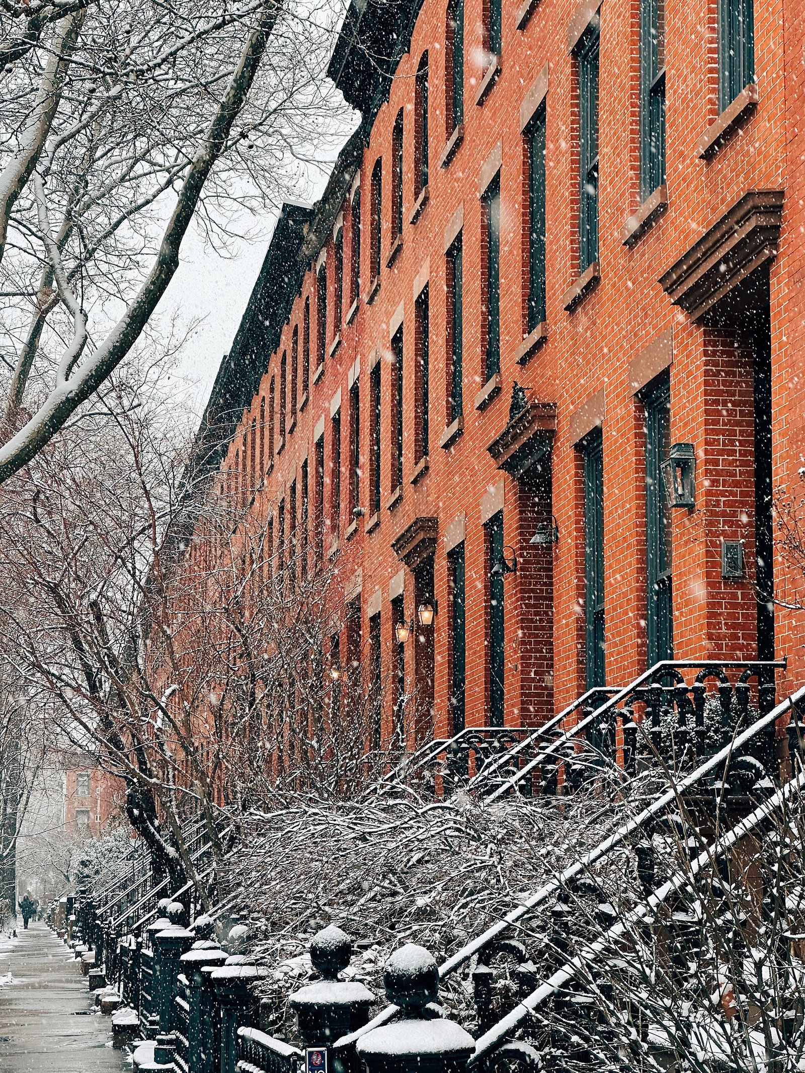
Ritchiee212121 · CC BY 4.0 · Resized.

Sources and visitor information
- Boerum Hill Historic District Extension designation reportNYC Landmarks Preservation Commission
- Boerum Hill Historic District Extension designationNYC Landmarks Preservation Commission
- F train line mapMetropolitan Transportation Authority
- G train line mapMetropolitan Transportation Authority